When the floodwaters recede, the hard part is often just beginning.
Long after the emergency response ends and the headlines disappear, communities are left navigating difficult questions about land, safety, identity, and what comes next. In many rural towns, FEMA buyouts and floodplain regulations create a complicated reality: properties are removed from the tax base, development options become severely restricted, and communities are left maintaining fragmented vacant land indefinitely.
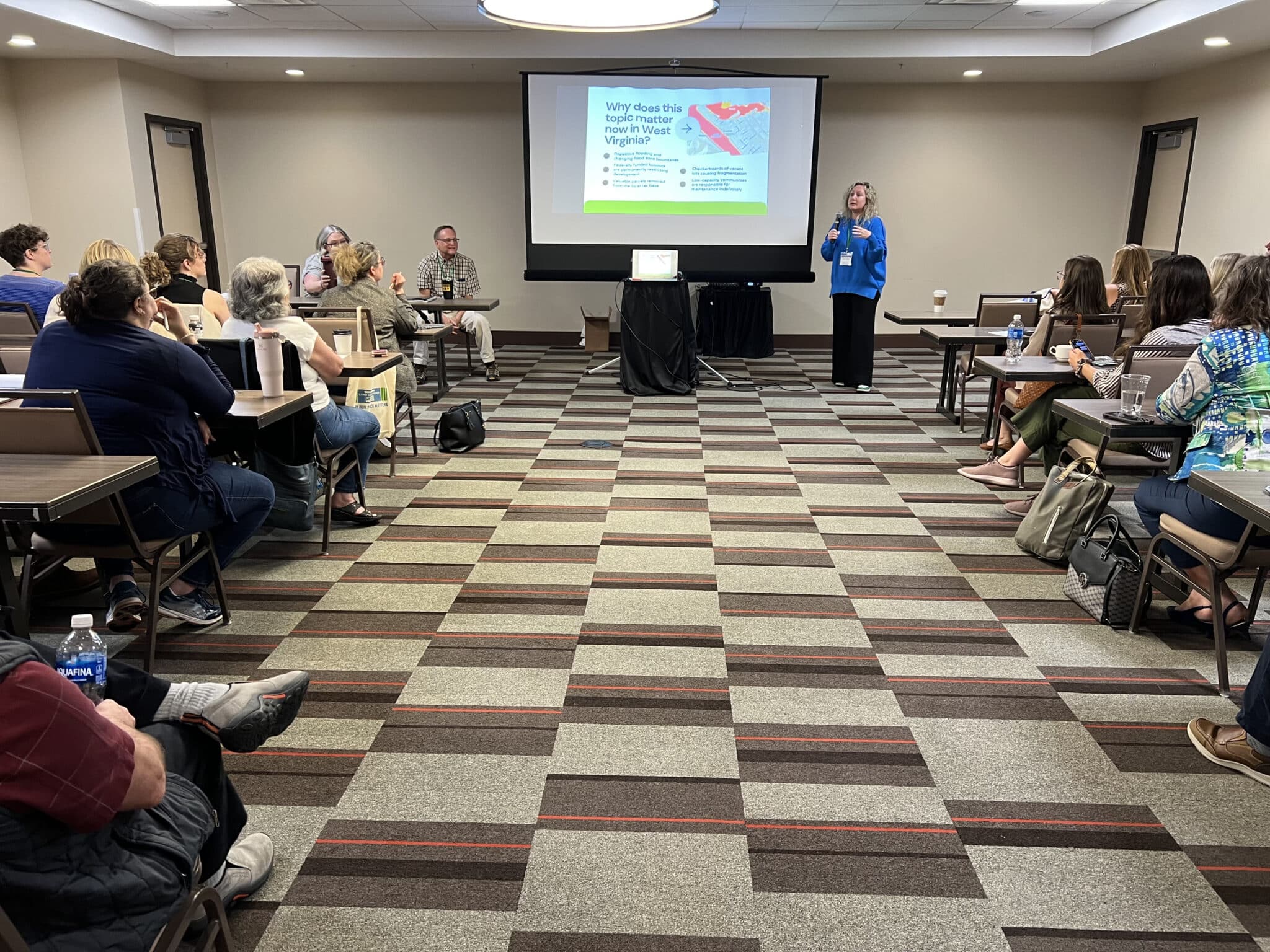
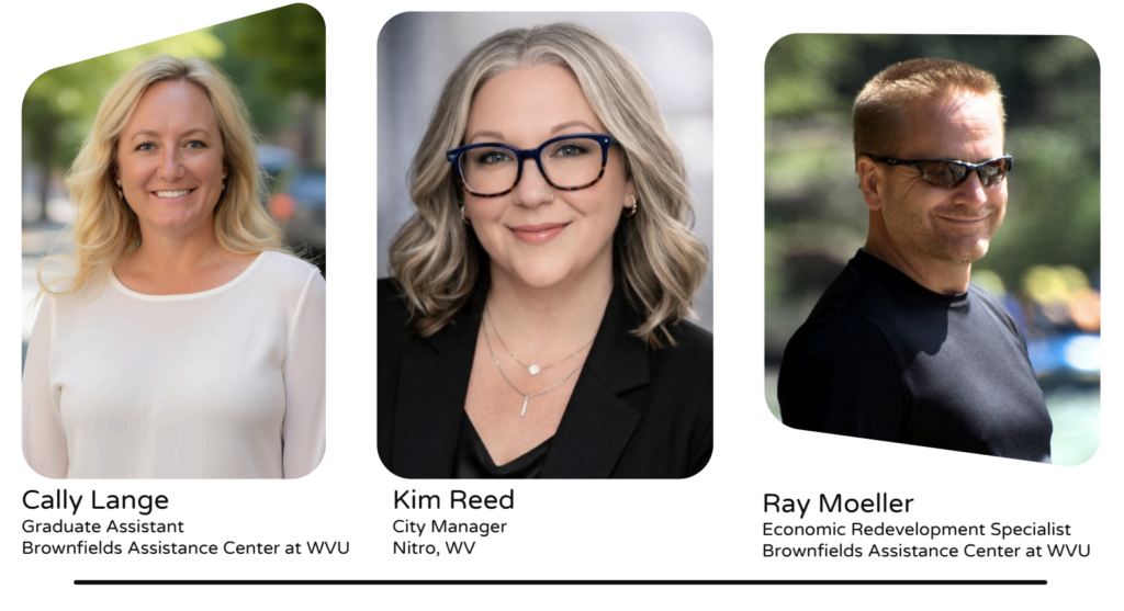
At the 2026 Mountain State Land Use Summit in West Virginia, Revival founder Cally Lange joined Ray Moeller of the West Virginia Brownfields Assistance Center and Nitro City Manager Kim Reed to explore a different approach—one rooted not just in hazard mitigation, but in long-term community vitality. Drawing from real-world examples across West Virginia, the session focused on how floodplain communities can think beyond abandonment and begin designing productive futures for vulnerable land.
The Systems Challenge Beneath the Surface
Floodplain redevelopment is often framed as a design problem, but in reality, it is usually a systems problem first.
Communities are navigating overlapping regulations, changing flood maps, funding limitations, preservation concerns, maintenance responsibilities, and long-term economic impacts—all while trying to protect the people and character that make a place worth preserving in the first place.
As Cally shared during the session:
“The better question is not ‘Can we build?’ but ‘What outcome best serves the community?’”
That shift in thinking changes everything.
Instead of treating floodplain land as leftover space or inevitable loss, communities can begin asking how these parcels might still support environmental stewardship, social connection, education, tourism, food systems, preservation, or local identity—even when traditional development is no longer possible.
Case Study #1: From FEMA Buyout to Community Apiary
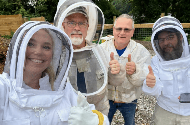
One of the clearest examples came from Nitro, West Virginia.
After severe riverbank erosion, FEMA declared a residential structure at 1320 Valentine Circle unsafe and the property became subject to strict deed restrictions tied to floodway regulations. Rather than allowing the parcel to sit vacant indefinitely, the City of Nitro and the Nitro Sustainable Community Group reimagined the site as something entirely different: a community apiary and pollinator garden.
The idea grew from local priorities already taking shape nearby. Residents had been organizing around urban agriculture, food security, and sustainability initiatives, including an active community garden adjacent to the newly acquired FEMA property.
What emerged was not just a creative reuse of restricted land, but a broader ecosystem of community engagement. Workshops, hive inspections, educational programming, mural projects, gardening initiatives, and local partnerships transformed what could have become a forgotten vacant lot into a space for stewardship and gathering.
The lesson was simple but powerful: “Floodplain land does not have to remain empty.”
Case Study #2: The Peacock Building
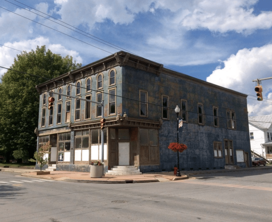
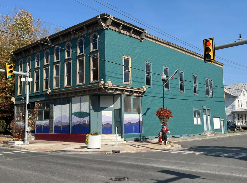
The second story explored a very different challenge: preservation in place.
Located in Marlinton, West Virginia, The Peacock Building sat prominently within the floodplain—historic, visible, deteriorating, and at risk. In many communities, buildings like this are quietly written off as too expensive, too damaged, or too difficult to save.
But the project team approached the situation differently. Historic structure experts, architects, engineers, and redevelopment partners were brought together early in the process. Instead of asking whether the building should simply be demolished, the team explored what pathways might still exist for adaptive reuse and long-term viability.
The process required coordination, patience, technical expertise, and local buy-in. It also required a willingness to “dare to be different,” as one presentation slide put it.
Ultimately, the project reinforced another key idea from the session:
“Preservation is often a systems challenge before it is a design challenge.”
Historic designation, strategic planning, and collaborative implementation created opportunities for the building to remain a meaningful part of Marlinton’s future rather than becoming another loss absorbed into the landscape.
Designing the Pathway, Not Just the Project
One of the strongest themes throughout the summit was the importance of early coordination and long-view thinking.
Too often, communities begin asking questions after floodplain restrictions or funding limitations have already narrowed the available options. But resilient outcomes require communities to think earlier, map parcels strategically, identify low-impact uses, and coordinate preservation and hazard mitigation efforts from the beginning.
At Revival, this kind of work sits at the intersection of architecture, systems thinking, implementation strategy, and rural revitalization. The work is not only about designing buildings. It is about designing pathways—helping communities navigate the realities of regulation, funding, preservation, risk, and long-term growth in ways that still leave room for imagination.
Because resilience is not just about what survives the flood.
It is about what communities are empowered to become afterward.